DOW-UAP-PR070, "IIR 1 655 S0301 23/Eglin AFB Aircrew Observed Unidentified Aerial Phenomena (UAP) on 13 Feb 23"
Investigation reading
This Release 02 item is an official Department of War / AARO video record from manifest row 130, published in the 5/22/26 WAR.GOV/PURSUE release and mirrored through DVIDS video ID 1007783. The uploader-defined title is IIR 1 655 S0301 23/Eglin AFB Aircrew Observed Unidentified Aerial Phenomena (UAP) on 13 Feb 23. That title is source/catalog language; it should not be treated by itself as proof of platform identity, sensor identity, target identity, or anomalous performance.
The official description says eight U.S. House members requested access to 51 potentially UAP-related records allegedly held by the Department of War and the Intelligence Community. AARO identified responsive materials held on a classified network and warns that many of these materials lack a substantiated chain of custody. For this row, AARO assesses that the video is likely derived from an infrared sensor aboard a U.S. military platform operating within the United States Northern Command area of responsibility in 2023, and says a user uploaded it to a classified network in March 2023.
The manifest lists incident date as 2023 and incident location as Southeastern United States. The DVIDS page lists date taken 02.13.2023, VIRIN 230213-D-D0360-2507, filename DOD_111720720, location (UNDISCLOSED LOCATION), and length 00:00:30. Those fields align with the title's 13 Feb 23 wording, but they do not by themselves resolve original custody, platform, sensor model, field of view, range, or scene geometry.
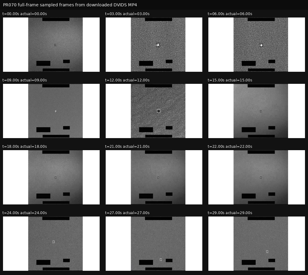
The source description identifies a short visual sequence: a sensor pans to keep an area of contrast near the center of the field of view while cycling contrast modes multiple times. It adds that at the 22-second mark the area of contrast loses distinctiveness against the background. The release itself says this description is informational only and should not be read as an analytical judgment, investigative conclusion, or factual determination.
What the released item appears to contain
The downloaded direct MP4 appears to show a compressed grayscale / infrared-looking sensor-display or processed-video view. The full-frame samples contain persistent display/framing elements: a bright vertical band along the left edge, a dark band along the right edge in many samples, and repeated black rectangular masks or overlays near the top and lower portions of the frame. Those elements are treated here as source-display, mask, redaction, or presentation features unless original sensor records prove otherwise.
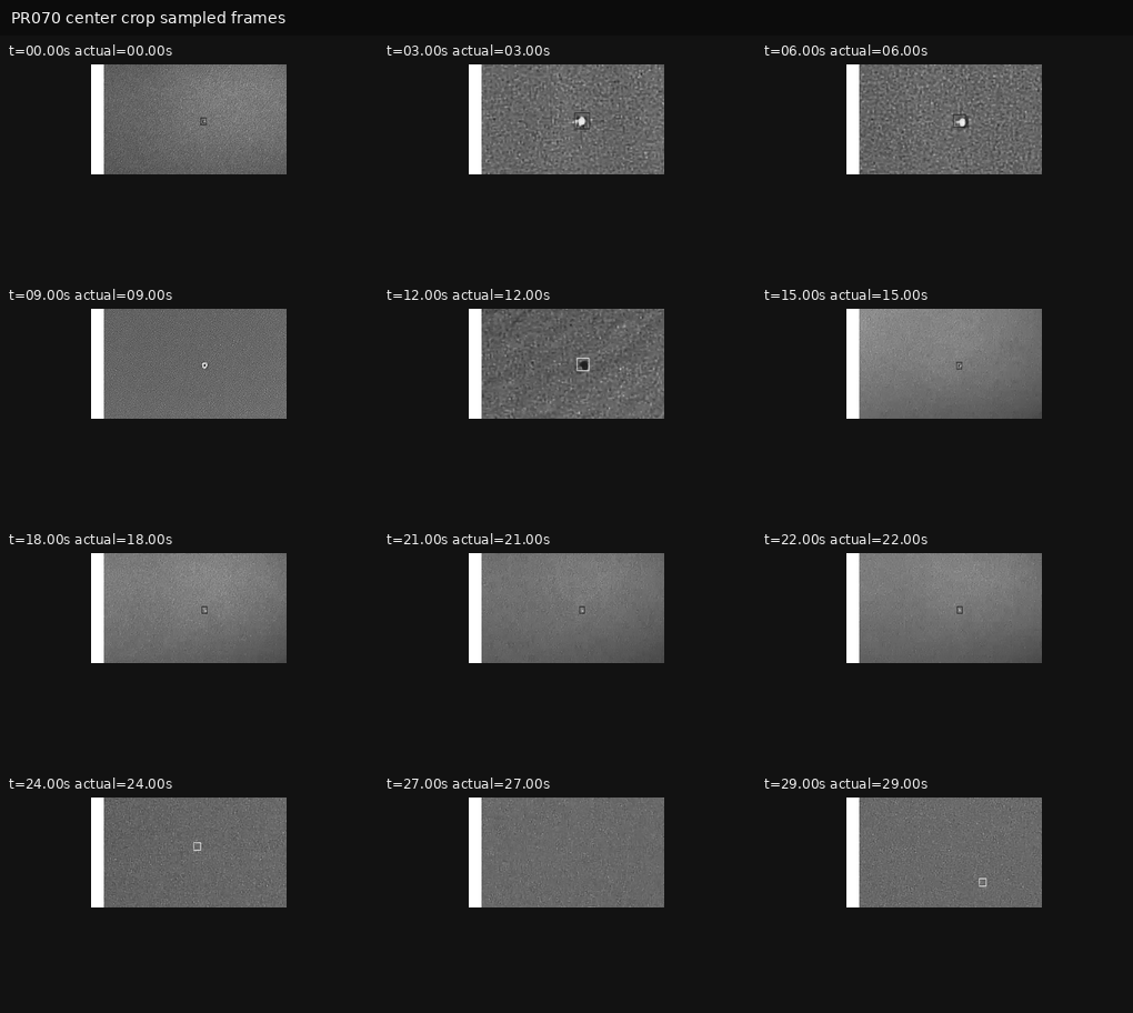
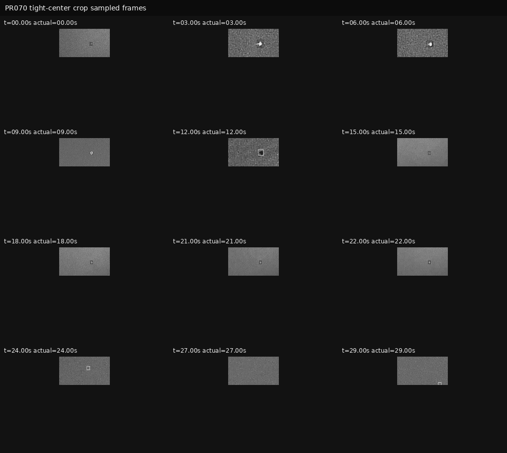
A small localized contrast feature or marker-like boxed speck is visible near the center region in many sampled frames. It is most conspicuous in the early samples around 00:03–00:06, then appears smaller, darker, or more outline-like in later samples. Around 00:21–00:22, the center crop is mostly uniform gray noise with a faint square-like contrast mark; by 00:27, the tight center crop is difficult to distinguish from the background, and at 00:29 a small boxed mark appears near the lower-right edge of the tight crop. This is broadly consistent with the official statement that the area of contrast loses distinctiveness against the background around the 22-second mark.
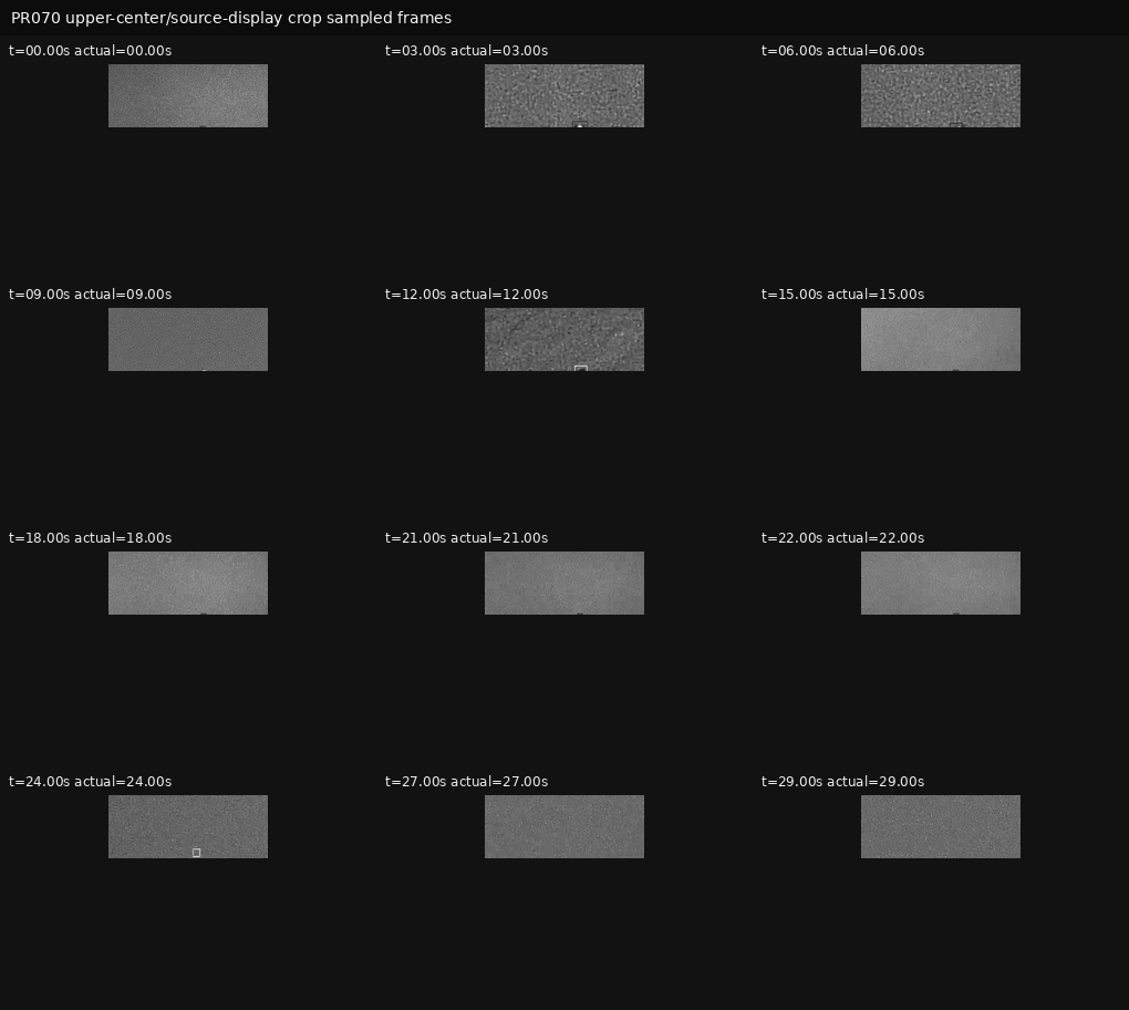
The upper-center crop does not add meaningful scene context beyond gray noise and faint overlay-like artifacts. No clear terrain, aircraft, vehicle, range cue, scale reference, or independently identifiable object is resolved in these sampled frames. The contact sheets below are derived review aids from the downloaded public MP4, not independent evidence.
Source asset review
The individual official DVIDS/CloudFront MP4 was downloaded and inspected directly; the full Release 02 video ZIP was not used as a substitute. The direct media response returned 200, content-type: binary/octet-stream, accept-ranges: bytes, content-length: 37550237, last-modified: Fri, 22 May 2026 11:31:09 GMT, and ETag "efc6c63db2bfd20dd4b0e00e45d35392-5". A byte-range probe returned 206 with content-range: bytes 0-0/37550237.
| Field | Source-review value |
|---|---|
| Direct media URL | https://d34w7g4gy10iej.cloudfront.net/video/2605/DOD_111720720/DOD_111720720.mp4 |
| Downloaded size | 37,550,237 bytes |
| SHA-256 | 80c8e1fc5ac44395d54468b5ef86b5cd9723ea568e9a9d6e5cf95e7265be6457 |
| CRC32 of downloaded direct MP4 | 1b9f5766 |
| Container | QuickTime / MP4 |
| Duration | 30.1 seconds |
| Video stream | H.264, 1920x1080, 30 fps, 903 frames, yuv420p |
| Audio stream | AAC stereo, 48,000 Hz, about 30.068 seconds |
| Audio signal check | decoded audio RMS 0.0, mean absolute sample 0.0, max absolute sample 0.0; effectively silent in this review |
| DVIDS filename / VIRIN | DOD_111720720 / 230213-D-D0360-2507 |
| DVIDS listed length | 00:00:30 |
The Release 02 remote video-ZIP central directory lists video_2605_DOD_111720720_DOD_111720720.mp4 as 37,545,001 bytes with CRC32 29d9368c, stored uncompressed. That does not match the downloaded direct DVIDS MP4 size or CRC32. Until the ZIP entry is byte-compared against the direct DVIDS object, this should be treated as a source-custody/versioning lead, not as a substantive finding about the imagery.
Source custody and provenance
Primary public provenance for this page is the official WAR.GOV/PURSUE Release 02 landing page, the Release 02 manifest row, and the DVIDS page for video 1007783. The DVIDS page resolves to https://www.dvidshub.net/video/1007783/dow-uap-pr070-iir-1-655-s0301-23-eglin-afb-aircrew-observed-unidentified-aerial-phenomena-uap-13-feb-23, with title DOW-UAP-PR070, "IIR 1 655 S0301 23/Eglin AFB Aircrew Observed Unidentified Aerial Phenomena (UAP) on 13 Feb 23", category B-Roll, date taken 02.13.2023, date posted 05.22.2026 07:31, location (UNDISCLOSED LOCATION), filename DOD_111720720, VIRIN 230213-D-D0360-2507, listed length 00:00:30, and courtesy source All Domain Anomaly Resolution Office.
The custody story is intentionally bounded. The public release says many responsive materials lack a substantiated chain of custody; the title mentions Eglin AFB aircrew and a 13 Feb 2023 event, while the body description more generally says AARO assesses the video is likely derived from an infrared sensor aboard a U.S. military platform in the United States Northern Command area of responsibility in 2023. This page preserves those source claims without converting them into findings about the platform, sensor, target, location, or event validity.
Graph context
No exact Release 02 graph record was returned for this slug, title, or DVIDS ID during this run's read-only graph context check. That is not a source-access problem; it means this page is currently anchored to official manifest/DVIDS provenance while graph ingest for Release 02 catches up. Future title-related or dataset-wide graph hits should be treated as leads until their provenance links resolve back to this exact official asset.
Leads to check
- Reconcile the manifest
Southeastern United Stateslocation, the title'sEglin AFB Aircrewwording, the DVIDS(UNDISCLOSED LOCATION)field, and the description's United States Northern Command-area wording before asserting a precise event location. - Byte-compare the direct DVIDS MP4 against the Release 02 video-ZIP entry because the direct-file size/CRC32 and ZIP central-directory size/CRC32 do not match.
- Review the contrast-mode cycles and the official
00:22loss-of-distinctiveness moment at original resolution with frame-by-frame stepping, stabilized coordinate tracking, and clear separation of display overlays from scene content. - Seek original sensor/custody metadata if available: platform, sensor model, field of view, zoom state, line of sight, range, track files, timestamps, and any aircrew or airspace context.
- Run prosaic checks before escalation if time/location can be narrowed: known aircraft or air traffic, balloons or debris, birds, clouds or atmospheric boundaries, drones, sensor/display artifacts, compression effects, and platform-motion artifacts.
Limits
This is a compressed, redacted public MP4 with no released platform telemetry, range, altitude, azimuth, sensor model, field of view, original sensor file, track file, or independent corroborating sensor record on this page. Persistent masks/overlays, low scene detail, silent audio, a direct-vs-ZIP size/CRC mismatch, and the chain-of-custody warning all limit interpretation. The contact sheets are useful for source review, but they are not a substitute for full-motion sensor analysis. This page is a source-review draft and not a finding.
Sources
- WAR.GOV/PURSUE Release 02 landing page: https://www.war.gov/UFO/
- DVIDS video page: https://www.dvidshub.net/video/1007783
- DVIDS direct media asset: https://d34w7g4gy10iej.cloudfront.net/video/2605/DOD_111720720/DOD_111720720.mp4
- Release 02 document bundle: https://www.war.gov/medialink/ufo/052226/release_02/release_02_document_bundle.zip
- Release 02 video bundle: https://d34w7g4gy10iej.cloudfront.net/uap052226.zip
- Official Release 02 manifest row 130,
DOW-UAP-PR070, "IIR 1 655 S0301 23/Eglin AFB Aircrew Observed Unidentified Aerial Phenomena (UAP) on 13 Feb 23", release date5/22/26, agencyDepartment of War, kindVID.