DOW-UAP-PR090, "24 AUG 2020 [CALLSIGN] (Mission) Observes UAP"
Investigation reading
This Release 02 item is an official Department of War / AARO video record from manifest row 150, published in the 5/22/26 WAR.GOV/PURSUE release and mirrored through DVIDS video ID 1007719. The public title is preserved as source/catalog language: "24 AUG 2020 [CALLSIGN] (Mission) Observes UAP". The redacted callsign field, the parenthetical Mission wording, and the word UAP are not treated here as independent Open Sky findings about platform identity, crew, target identity, event significance, or the nature of the visible contrast feature.
The official release description says eight U.S. House members requested access to 51 potentially UAP-related records allegedly held by the Department of War and the Intelligence Community. AARO identified responsive materials held on a classified network and warns that many of these materials lack a substantiated chain of custody. For this row, AARO assesses that the public video is likely derived from an infrared sensor aboard a U.S. military platform operating within the United States Central Command area of responsibility in 2020, and says a user uploaded the video to a classified network in August 2020.
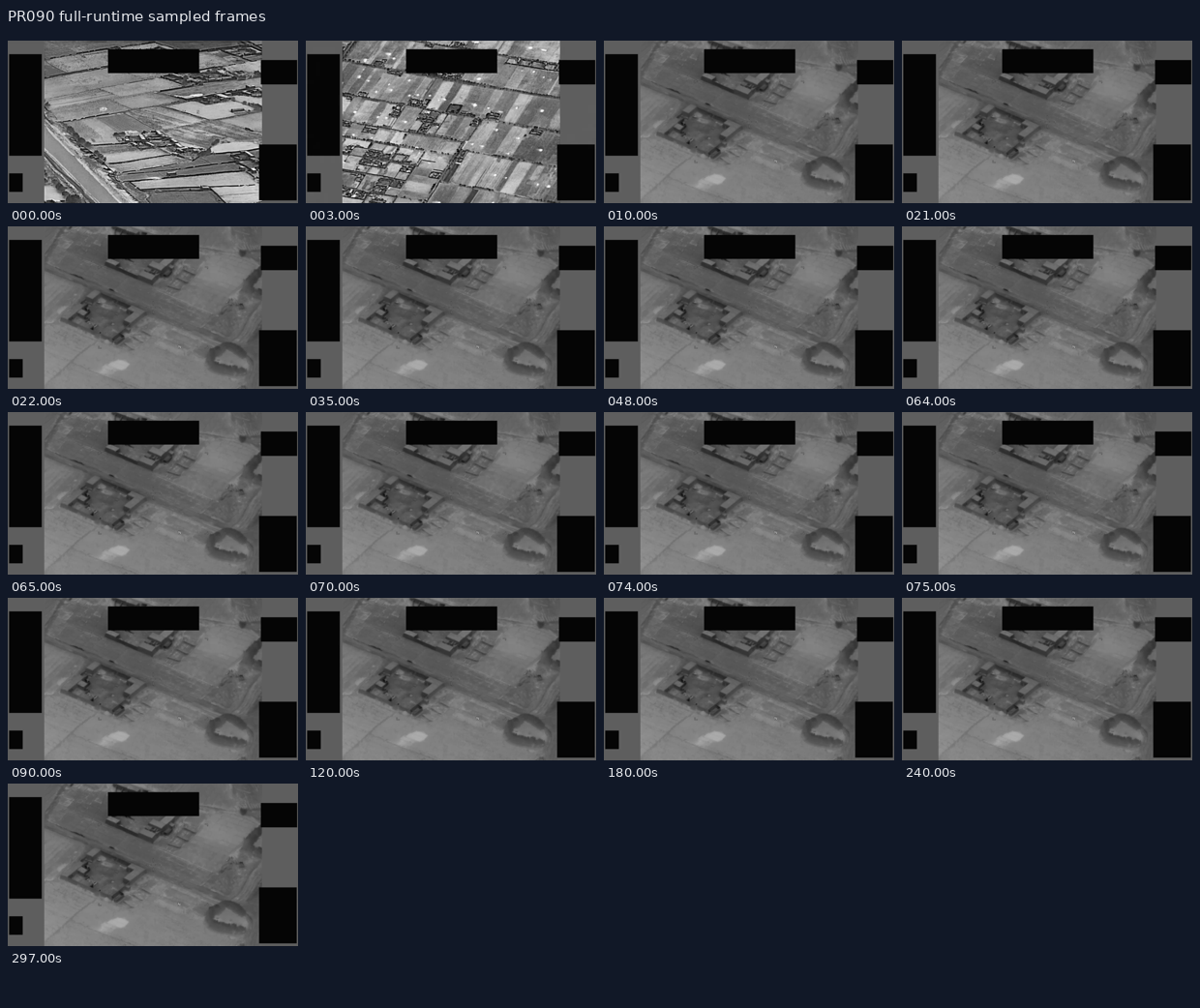
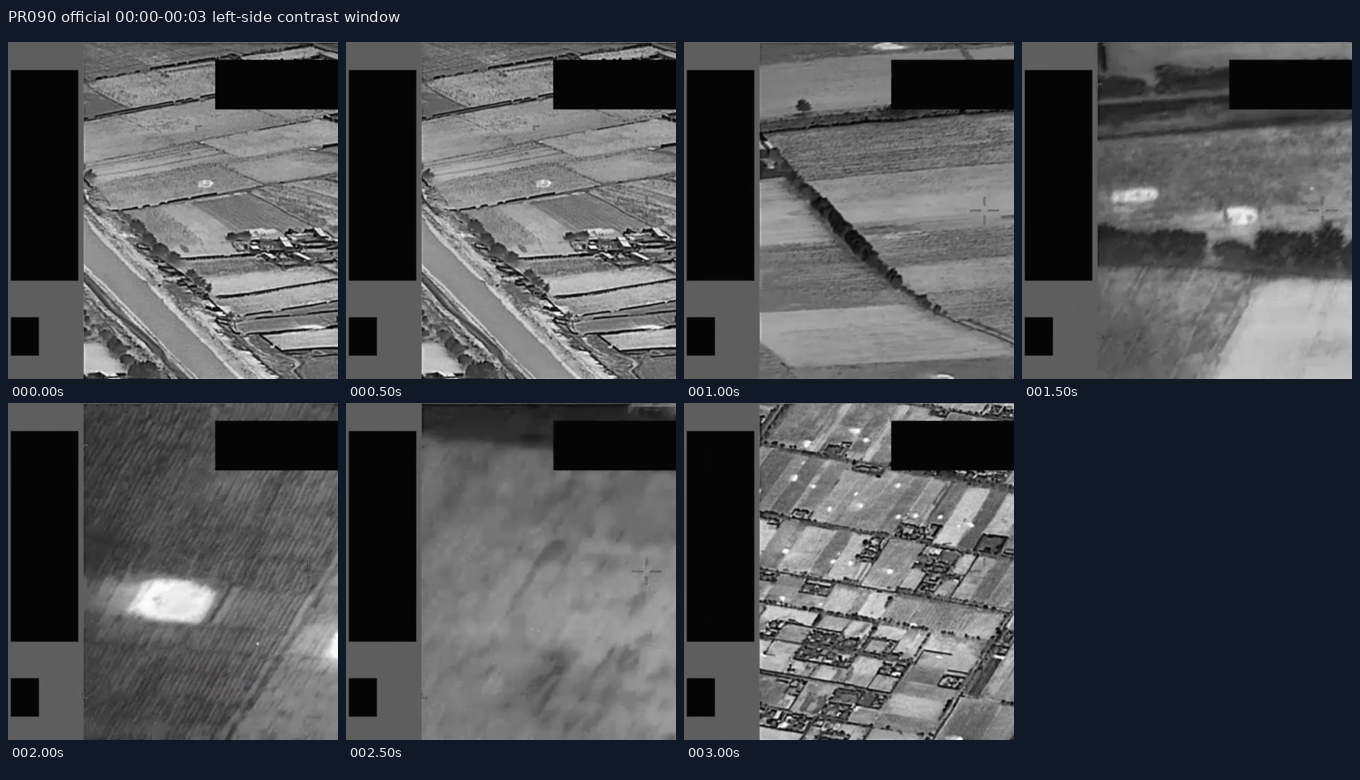
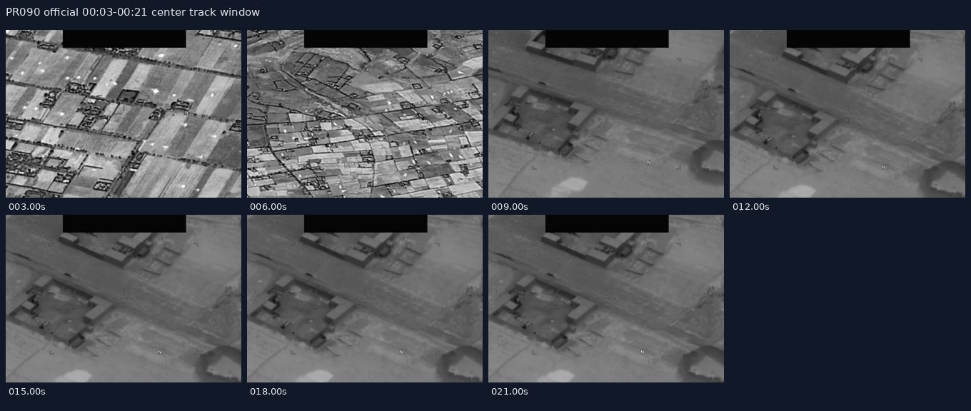
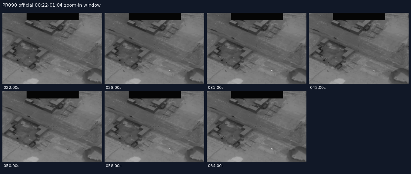
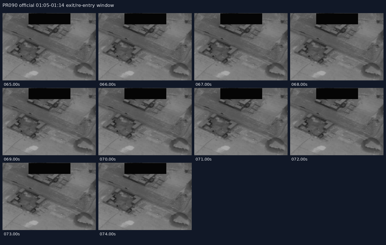
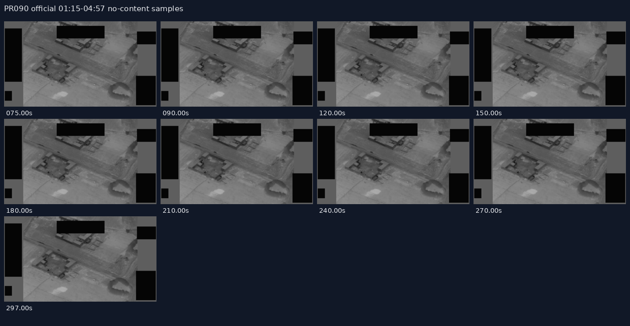
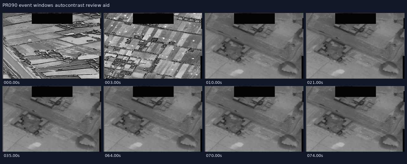
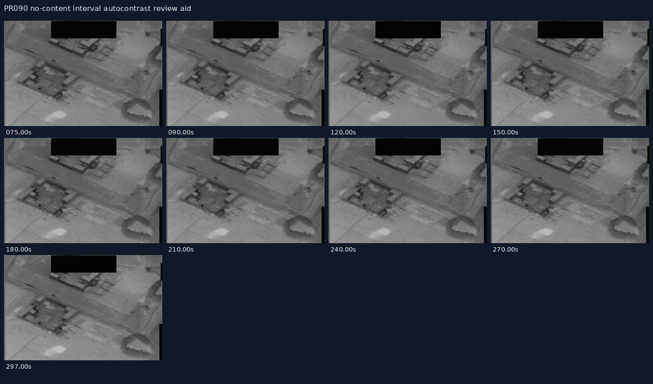
The source-provided video description lists a duration of 00:04:57. It breaks the public clip into these windows: 00:00 to 00:03, the sensor tracks an area of contrast as it moves down the left side of the screen; 00:03 to 00:21, the sensor pans to track the area of contrast within the center of its field of view; 00:22 to 01:04, the sensor zooms in on the area of contrast; 01:05 to 01:14, the area of contrast exits and re-enters the field of view several times; and 01:15 to 04:57, No content. The same source text is explicitly informational only and should not be interpreted as an analytical judgment, investigative conclusion, or factual determination about the described event's validity, nature, or significance.
The DVIDS page resolves to a canonical page for video 1007719 and lists date taken 08.24.2020, date posted 05.22.2026 07:30, category B-Roll, video ID 1007719, VIRIN 200824-D-D0360-4026, filename DOD_111719746, length 00:04:58, and location (UNDISCLOSED LOCATION). The DVIDS listed length and downloaded MP4 duration are about one second longer than the manifest/source-description duration field; that is a custody/versioning note, not a substantive finding about the imagery.
What the released item appears to contain
The downloaded direct MP4 is a 1280×720 monochrome / infrared-style aerial sensor-display clip. Sampled frames show terrain-like imagery: fields or open ground, diagonal roads or tracks, rectangular building or compound-like structures, and low-contrast surface texture. Multiple black rectangular masks or redaction blocks remain visible near the top, left, and right portions of the frame; these overlays obscure parts of the image and should not be read as natural scene content. Some frames also show faint reticle or display markings.
In the 00:00 to 00:03 source-described left-side window, cropped samples show rapidly changing high-contrast terrain, field edges, roads, and small structure-like shapes along the left side. A contrast region can be followed cautiously in the left-side crop, but the rapid view change and redaction masks make it unsafe to isolate a discrete object or reconstruct a precise path from stills alone.
In the 00:03 to 00:21 center-track window, sampled center crops show the sensor view settling over a broader field/compound scene. In the 00:22 to 01:04 source-described zoom-in window, the central road/compound scene remains visible with low-contrast tonal changes and increased emphasis on the same general area. These still frames are broadly compatible with the source's pan/track/zoom wording at a catalog level, but they do not independently identify the contrast feature or establish speed, distance, altitude, range, or cause.
In the 01:05 to 01:14 source-described exit/re-entry window, one-second sampled crops show a mostly stable aerial view of a rural compound/road scene with a black redaction block across the upper central area. The still contact sheet does not clearly confirm a discrete subject exiting and re-entering the field of view. The safest reading is to keep the exit/re-entry language attributed to the official description and treat the stills as triage aids rather than motion reconstruction.
In the 01:15 to 04:57 source-described No content interval, sampled frames are not visually blank. They continue to show sensor imagery, terrain/compound features, overlays, and masks. Within the sampled no-content interval, no clear independently identifiable subject or event is apparent from the contact sheets. No content should therefore be read as source catalog language for absence of the described event content, not as a statement that the public MP4 contains no pixels or no visible background imagery.
The MP4 includes an AAC stereo audio stream, but a full decoded audio check returned zero signal in this source review (RMS 0.0, mean absolute sample 0.0, max absolute sample 0.0). No transcript or audible content is quoted here. The contact sheets below are derived review aids from the downloaded official MP4; they are not independent evidence and should not be used to infer cause, identity, speed, range, altitude, or event significance.
Source asset review
The individual official DVIDS/CloudFront MP4 was downloaded and inspected directly; the full Release 02 video ZIP was not used as a substitute. The direct media response returned 200, content-type: binary/octet-stream, accept-ranges: bytes, content-length: 119599140, last-modified: Fri, 22 May 2026 11:30:34 GMT, and ETag "f8870d57834ef0fdc6cbd8f5f9b2c8d1-15". A byte-range probe returned 206 with content-range: bytes 0-15/119599140; the first 16 bytes were MP4/M4V header bytes 0000001c667479704d34562000000001.
| Field | Source-review value |
|---|---|
| Direct media URL | https://d34w7g4gy10iej.cloudfront.net/video/2605/DOD_111719746/DOD_111719746.mp4 |
| Downloaded size | 119,599,140 bytes |
| SHA-256 | 72064ff4b0b221a386db7ce76b97043feadc9b436d9ceaa019b381a986c12d51 |
| CRC32 of downloaded direct MP4 | 07665fec |
| Container | QuickTime / MOV (mov,mp4,m4a,3gp,3g2,mj2) |
| Duration | 298.0 seconds (DVIDS lists 00:04:58; manifest/source description lists 00:04:57) |
| Bit rate | 3,210,715 bps |
| Video stream | H.264, 1280x720, 30 fps, 8,940 frames, yuv420p |
| Audio stream | AAC stereo, 48,000 Hz, about 297.950667 seconds, 13,968 stream frames |
| Audio signal check | 13,967 decoded audio frames / 28,603,264 sample values; RMS 0.0, mean absolute sample 0.0, max absolute sample 0.0; audio stream present but effectively silent in this decode |
| DVIDS filename / VIRIN | DOD_111719746 / 200824-D-D0360-4026 |
| DVIDS listed length | 00:04:58 |
The Release 02 remote video-ZIP central directory lists video_2605_DOD_111719746_DOD_111719746.mp4 as 119,593,826 bytes with CRC32 8dc3dbc9, stored uncompressed. That does not match the downloaded direct DVIDS MP4 size or CRC32; the direct object is 5,314 bytes larger than the ZIP central-directory entry. Until the ZIP entry is byte-compared against the direct DVIDS object, this should be treated as a source-custody/versioning lead, not as a substantive finding about the imagery.
Source custody and provenance
Primary public provenance for this page is the official WAR.GOV/PURSUE Release 02 landing page, the Release 02 manifest row, and the DVIDS page for video 1007719. The public DVIDS page resolves to https://www.dvidshub.net/video/1007719/dow-uap-pr090-24-aug-2020-callsign-mission-observes-uap and exposes the direct media asset at https://d34w7g4gy10iej.cloudfront.net/video/2605/DOD_111719746/DOD_111719746.mp4.
The custody posture is intentionally bounded. The public release says many responsive materials lack a substantiated chain of custody. This row says the video was uploaded to a classified network in August 2020 and is likely derived from an infrared sensor aboard a U.S. military platform operating within the CENTCOM area of responsibility in 2020. DVIDS adds a 08.24.2020 date taken, (UNDISCLOSED LOCATION) location, VIRIN 200824-D-D0360-4026, and filename DOD_111719746. Those fields are useful public catalog facts, but they do not provide original sensor metadata, platform identity, coordinates, range, altitude, precise time of day, or continuous chain-of-custody documentation. This page preserves the official manifest/DVIDS provenance and downloaded-source inspection facts without converting the title, visible contrast, or AARO summary into an Open Sky finding.
Graph context
No exact Release 02 graph record was returned for this slug, title, or DVIDS ID during this run's read-only graph context check. That is not a source-access problem; it means this page is currently anchored to official manifest/DVIDS provenance while graph ingest for Release 02 catches up. Future title-related or dataset-wide graph hits should be treated as leads until their provenance links resolve back to this exact official asset.
Leads to check
- Byte-compare the direct DVIDS MP4 against the Release 02 video-ZIP entry because the direct-file size/CRC32 and ZIP central-directory size/CRC32 do not match.
- Reconcile the one-second duration tension: the manifest/source description says
00:04:57, while DVIDS lists00:04:58and the downloaded MP4 container duration is298.0seconds. - Review the event windows in continuous full-resolution motion, especially
00:00to00:03,00:03to00:21,00:22to01:04, and01:05to01:14; still contact sheets are triage aids, not sufficient event reconstruction. - Reconcile the source title's
Observes UAPlanguage with the body description's more cautiousarea of contrastwording; the title alone should not be used as an identity, performance, or significance finding. - Identify the original sensor type, display polarity, reticle/overlay meaning, masking/redaction behavior, platform position, line of sight, range, precise time, and any companion mission or operator notes.
- Run prosaic context checks before escalation: ordinary aircraft, drones, birds, balloons, debris, ground or maritime traffic, terrain/structure contrast, heat sources, glint/reflection, atmospheric effects, sensor gain or contrast processing, platform parallax, compression/display artifacts, redaction artifacts, CENTCOM activity on 24 August 2020, weather, satellite/launch/reentry context, and any available military or civilian incident logs.
Limits
This is a compressed public MP4 derived from a classified-network upload, and the release-level source warning says many responsive materials lack a substantiated chain of custody. The public record does not provide the original file hash, original sensor metadata, platform identity, precise time of day, line of sight, range, altitude, coordinates, independent radar or optical tracks, air/ground/maritime traffic correlation, weather correlation, or original witness/operator notes on this page. The source-described area of contrast remains unresolved from this asset alone. This page is a source-review draft and not a finding.
Sources
- WAR.GOV/PURSUE Release 02 landing page: https://www.war.gov/UFO/
- DVIDS video page: https://www.dvidshub.net/video/1007719
- DVIDS canonical video page: https://www.dvidshub.net/video/1007719/dow-uap-pr090-24-aug-2020-callsign-mission-observes-uap
- DVIDS direct media asset: https://d34w7g4gy10iej.cloudfront.net/video/2605/DOD_111719746/DOD_111719746.mp4
- Release 02 document bundle: https://www.war.gov/medialink/ufo/052226/release_02/release_02_document_bundle.zip
- Release 02 video bundle: https://d34w7g4gy10iej.cloudfront.net/uap052226.zip
- Official Release 02 manifest row 150,
DOW-UAP-PR090, "24 AUG 2020 [CALLSIGN] (Mission) Observes UAP", release date5/22/26, agencyDepartment of War, kindVID.